


BUTTON Voting District, Ford County, Illinois
About
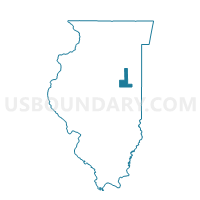
Outline

Summary
| Unique Area Identifier | 570888 |
| Name | BUTTON Voting District |
| County | Ford County |
| State | Illinois |
| Area (square miles) | 34.10 |
| Land Area (square miles) | 34.04 |
| Water Area (square miles) | 0.06 |
| % of Land Area | 99.84 |
| % of Water Area | 0.16 |
| Latitude of the Internal Point | 40.44749980 |
| Longtitude of the Internal Point | -87.99300400 |
Maps


Graphs
Select a template below for downloading or customizing gragh for BUTTON Voting District, Ford County, Illinois


Neighbors
Neighoring Voting District (by Name) Neighboring Voting District on the Map
- BUTLER 1 Voting District, Vermilion County, IL
- HARWOOD Voting District, Champaign County, IL
- KERR Voting District, Champaign County, IL
- LODA Voting District, Iroquois County, IL
- PATTON 4 Voting District, Ford County, IL
- PATTON 7 Voting District, Ford County, IL
- PIGEON GROVE Voting District, Iroquois County, IL
Top 10 Neighboring County Subdivision (by Population) Neighboring County Subdivision on the Map
- Patton township, Ford County, IL (5,358)
- Loda township, Iroquois County, IL (1,461)
- Pigeon Grove township, Iroquois County, IL (1,155)
- Butler township, Vermilion County, IL (992)
- Harwood township, Champaign County, IL (623)
- Button township, Ford County, IL (281)
- Kerr township, Champaign County, IL (163)
Top 10 Neighboring Elementary School District (by Population) Neighboring Elementary School District on the Map
- Gifford Community Consolidated School District 188, IL (1,844)
- Armstrong-Ellis Consolidated School District 61, IL (906)
Top 10 Neighboring Secondary School District (by Population) Neighboring Secondary School District on the Map
Top 10 Neighboring Unified School District (by Population) Neighboring Unified School District on the Map
- Paxton-Buckley-Loda Community Unit School District 10, IL (8,710)
- Hoopeston Area Community Unit School District 11, IL (7,293)
- Cissna Park Community Unit School District 6, IL (1,826)
Top 10 Neighboring State Legislative District Lower Chamber (by Population) Neighboring State Legislative District Lower Chamber on the Map
Top 10 Neighboring State Legislative District Upper Chamber (by Population) Neighboring State Legislative District Upper Chamber on the Map
Top 10 Neighboring 111th Congressional District (by Population) Neighboring 111th Congressional District on the Map
Top 10 Neighboring Census Tract (by Population) Neighboring Census Tract on the Map
- Census Tract 104, Champaign County, IL (4,809)
- Census Tract 101, Vermilion County, IL (3,306)
- Census Tract 9507, Iroquois County, IL (2,954)
- Census Tract 9508, Iroquois County, IL (2,521)
- Census Tract 9617, Ford County, IL (2,236)
Top 10 Neighboring 5-Digit ZIP Code Tabulation Area (by Population) Neighboring 5-Digit ZIP Code Tabulation Area on the Map
- 60957, IL (5,615)
- 60924, IL (1,635)
- 60948, IL (1,533)
- 60960, IL (1,064)
- 60949, IL (636)
- 61862, IL (510)